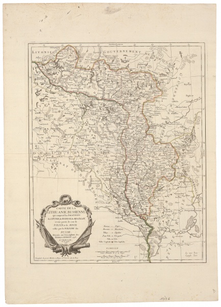
CARTE DE LA LITHUANIE RUSSIENE qui comprend les PALATINATS de LIVONIE, de WITEBSK, de MISCISLAW et une partie de ceux de POLOCK et de MINSK cedes par la POLOGNE ala RUSSIE
| Author: |
Paolo Santini (1729–1793)  |
| Created: | 1776 |
| Material: | paper |
| Technique: | copper engraving |
| Dimensions: | 56 × 45.50 cm |

P. Santini copied the map of the eastern territories of the GDL annexed to Russia after the first partition of the Commonwealth from an analogous map by the firm of German cartographers Homann Heirs and indicated that in the cartouche.
Source: Law firm Valiunas Ellex art album LITUANIA IN ATLANTIBUS (2011). Text author Algimantas Muzikevičius