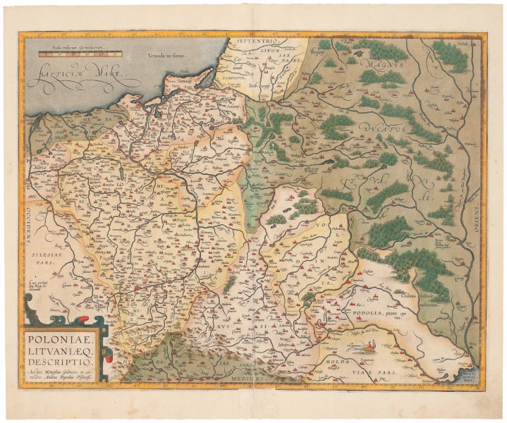

Poloniae, Lituaniaeq. Descriptio...
| Authors: |
Waclaw Grodecki (1535–1591) Abraham Ortelius (1527–1598) |
| Created: | 1612 |
| Material: | paper |
| Technique: | copper engraving |
| Dimensions: | 48.70 × 37.30 cm |
There was no separate map of Lithuania in A. Ortelius’ atlases, although the whole Grand Duchy of Lithuania or its separate parts were marked in several maps. The main one is the map Poloniae Litvaniaeq descriptio by Waclaw Grodecki. That map was included in A. Ortelius’ atlases from 1595 to 1612. Three thousand and fifty copies of such atlases are believed to have been printed within that period.
Source: Law firm Valiunas Ellex art album DELINEATIO LITUÆ (2009). Text authors Jevgenij Machovenko, Algimantas Muzikevičius, LITUANIA IN ATLANTIBUS (2011). Text author Algimantas Muzikevičius


